The Community Connector Trail is a multi-use trail of approximately 4.5 miles in length and it connects the Towns of Clifton Park and Halfmoon. Much of the trail is located within the Vischer Ferry Nature and Historic Preserve.
Two parking lots adjoin the trail within the Town of Clifton Park; one at the trailhead at the end of Ferry Drive and another at approximately the halfway point along this trail at the intersection of Riverview and Van Vranken roads (which also serves as the main parking lot for the Visher Ferry Nature and Historic Preserve). A small parking lot is also available in the Town of Halfmoon, located across from the terminus of this trail along Towpath Road.
View the general location map.

This trail is wheelchair accessible. The trail surface is stone dust (crushed shale).
Some views along this trail –

Info signs at trailhead parking lot

More info signs at trailhead parking lot

History interpretative sign at trailhead parking lot

Kiosk at trailhead parking lot


Mohawk Towpath Byway history interpretative sign at trailhead parking lot


Looking SE’ly along trail from trailhead parking lot

Looking SSE’ly at Mohawk River from beginning of trail

Guided nature and history interpretative trail sign

Looking S’ly along trail

Looking SE’ly at intersection with VFNHP trail that passes S of dredge spoil containment area


Looking E’ly along trail toward Old Lock #19

Old Lock #19

Mileage marker across from Old Lock #19

Looking E’ly along trail just E of Old Lock #19

Nature interpretive sign

Looking NE’ly along trail


Mileage marker at intersection with Troop 22 Trail at Vischer Ferry Nature & Historic Preserve

Looking NE’ly along trail

Looking ENE’ly along trail where woodland transitions to marshland

Looking ENE’ly along trail

Looking SSE’ly across open water feature and marshland along trail

Looking E’ly along trail

Looking NE’ly along trail

Looking NE’ly along trail

Looking NE’ly along trail

Looking NE’ly along trail toward Whipple Bridge

Looking NE’ly at Whipple Bridge

Whipple Bridge

Looking SW’ly from S end of Whipple Bridge

Looking SSE’ly along trail segment S of Whipple Bridge

Looking at curve heading NW’ly at Fort’s Ferry history interpretative sign

Fort’s Ferry history interpretative sign

Looking NE’ly along trail segment E of Fort’s Ferry history interpretative sign

Telecommunications building along trail

Looking NE’ly along trail E of telecommunications building

Looking SE’ly from trail at Mohawk River access

Looking SE’ly from trail at picnic area along Mohawk River just E of Mohawk River access

Looking N’ly along trail just S of bridge over former canal

Looking E’ly from bridge over former canal

Looking W’ly from bridge over former canal

Looking NNE’ly along trail N of bridge over former canal

Looking at curve bearing NE’ly along former canal

Looking ESE’ly along former canal at former canal bridge abutment

Looking ESE’ly along trail at intersection with Tommy’s Trail (Mohawk River Overlook)


View of Mohawk River from Tommy’s Trail

Acknowledgment sign regarding Eagle Scout project for Tommy’s Trail

Looking ESE’ly along trail E of intersection with Tommy’s Trail

Looking NE’ly from trail at Clute’s Dry Dock

Looking SE’ly along trail E of Clute’s Dry Dock

Looking SE’ly along trail with view of Mohawk River

Looking at curve heading E’ly and view looking SE’ly across bay and outlet of Wager’s Pond into Mohawk River

Looking ENE’ly at bridge over Wager’s Pond outlet into bay of Mohawk River

Looking N’ly at Wager’s Pond outlet

Looking SSW’ly at Wager’s Pond outlet into bay of Mohawk River

Looking ENE’ly along trail just E of bridge over Wager’s Pond outlet

Looking SSW’ly across small pond S of trail and E of bridge over Wager’s Pond outlet

Looking ENE’ly along trail E of pond S of trail

Looking ENE’ly along trail and former canal, not far W of I-87

Looking at curve heading SE’ly parallel to I-87 (“Twin Bridges” over Mohawk River are visible in background)

Looking SE’ly along trail and parallel with “Twin Bridges” of I-87 over Mohawk River

Looking S’ly at switchback along trail at its terminus at Towpath Road in Town of Halfmoon. Note small parking area across from trail terminus at end of Towpath Road.
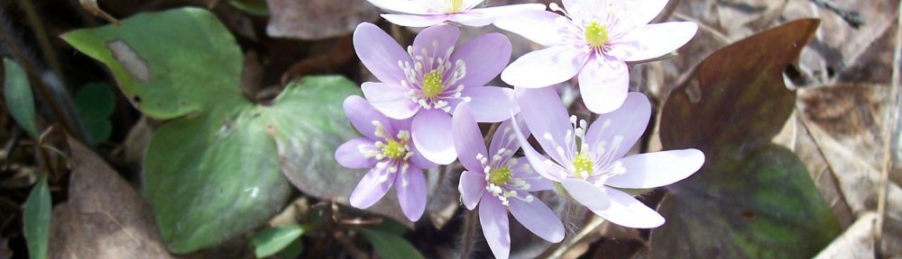
View my wildflower field guide for this trail system. If you wish to download a copy to your smartphone or tablet for trailside use, simply scan this quick read bar code:

A Wildflower Field Guide ~ Community Connector Trail
