While this trail runs from the City of Albany to Rotterdam Junction, the segment featured on this webpage is the ~8-mile portion between the Alexander Street Trailhead in the City of Cohoes to the intersection of Buhrmaster Road and River Road in the Town of Colonie. This portion and the next ~8-mile portion immediately west of it are the subject of the Flowers of the Mohawk Hudson Bike-Hike Trail project created and administered by Kevin Kenny on iNaturalist.
Much of this is a rail trail, created from portions of the Troy & Schenectady Railroad, which was taken out of service in January 1965.
There are multiple, but small, parking areas along this segment:
Albany to Cohoes section (i.e., north of Alexander Street trailhead in City of Cohoes)
Cohoes to Rotterdam Junction section (i.e., continuing westward to intersection of Buhrmaster Road and River Road in the Town of Colonie)
Town of Colonie section (which is most of ~8-mile portion described on this webpage)
This trail is wheelchair accessible; it has an asphalt surface. However, please be advised that the entrance from Island View Road is a long and rather steep slope (particularly when existing the trail from this hill) and may not be safe for non-motorized wheelchair use.
Views along this ~8-mile portion of this trail include –
Alexander Street to Vliet Blvd (1.31 miles):
NOTE: The segment between Johnson Avenue and Vliet Boulevard remains closed due to reconstruction of the trail.
Looking NNE’ly from Alexander Street trailhead entranceLooking N’ly @ one of several short segments bordered by wooden fenceLooking NNE’ly @ Columbia Street overpass (background) and entrance (on left) from Shannon AvenueLooking N’ly (concrete post monument on right)Looking NNW’ly @ High Street overpass and handicapped access ramp from Younglove Avenue (on left)Looking NW’ly @ tunnel beneath Johnson Avenue and access to Johnson Avenue (on left)
Vliet Boulevard to access from N. 3rd Street / Glynn Drive (1.24 miles):
NOTE: The segment between Vliet Boulevard and Lansing Lane remains closed due to reconstruction of the trail.
Looking NNW’ly @ cleared area on rightLooking NNW’ly toward Lansing Lane (distant background)Looking NNW’ly @ intersection with Lansing LaneLooking NW’ly @ intersection with Manor AvenueLooking NW’ly along trail where it cuts through a hill covered with dense forest canopyLooking NW’ly @ pullover area along trailLooking NW’ly @ entrance (from right) to access from Heritage CourtLooking NW’ly @ entrance (on left) to access from N. 3rd Street / Glynn Drive
Access from N. 3rd Street / Glynn Drive to Schermerhorn Drive (1.35 miles):
Looking NW’ly along segment between access from N. 3rd Street / Glynn Drive and Schermerhorn RoadLooking WNW’ly toward tunnel beneath U.S. Route 9Looking WNW’ly @ intersection with access from parking lot off Route 9Looking W’ly @ intersection with access from Northern Pass residential development from leftLooking WSW’ly @ intersection with Shelter Cove Connection from right (background)Looking SW’ly @ intersections with access from Colonie Mohawk River Park (foreground) and with Schermerhorn Road (background) along the segment between the access from N. 3rd Street / Glynn Drive to Schermerhorn Drive
Looking S’ly at entrance to Shelter Cove Connection from end of Nantucket StreetLooking SSW’ly along access pathway just past pumping station on leftLooking SSW’ly at serpentine curve along access pathway just north of bridge over unnamed streamLooking S’ly at bridge over unnamed stream along access pathwayLooking SW’ly at serpentine curve along access pathway across from baseball field; entrance to Mohawk Hudson Bike-Hike Trail is in center background of image.
Schermerhorn Drive to Dunsbach Ferry Road / Island View Drive (1.0 mile):
Looking S’ly at signs and benches next to parking lot @ Schermerhorn DriveWatch for and respect other trail users!Looking SSW’ly along segment between Schermerhorn Drive to Dunsbach Ferry Road / Island View DriveLooking SW’ly along segment between Schermerhorn Drive to Dunsbach Ferry Road / Island View DriveLooking SW’ly near end of segment between Schermerhorn Drive to Dunsbach Ferry Road / Island View Drive (access from Dunsbach Ferry Road in distant background and access from Arbor Gate Court and Island View Road from right)
Island View Road to Forts Ferry Road (1.75 miles):
Looking SSE’ly uphill from entrance off Island View Road NOTE: This trail has an asphalt surface and is wheelchair accessible. However, please be advised that this entrance is a long and rather steep slope (particularly when existing the trail from this hill) and may not be safe for non-motorized wheelchair use.Looking SSE’ly @ sharp right turn across from bicycle rackLooking WSW’ly @ forested corridor prior to crossing cleared right-of-way with overhead powerlinesLooking WNW’ly within fenced trail corridor after crossing service road near sewage treatment plantLooking WNW’ly across from open water wetland where overhead powerlines cross trailLooking WSW’ly @ intersection with Onderdonk AvenueLooking SSW’ly @ intersection with Forts Ferry Road
Forts Ferry Road to Buhrmaster Road (1.35 miles):
Looking SSW’ly shortly after crossing Onderdonk AvenueLooking SSW’ly @ intersection with Forts Ferry RoadLooking SSW’ly @ benchLooking SSW’ly @ benches (each with overlook of Mohawk River) with bridge over Shakers Creek in distant backgroundLooking SSW’ly @ River Road overlooking marsh along Mohawk RiverLooking SSW’ly @ farm crossing from River RoadLooking SSW’ly @ access (on left) from Fox PreserveLooking WSW’ly @ access to Chrissy B’s Farm and Greenhouse (from left)Looking WNW’ly @ bench across from intersection of River Road and Buhrmaster Road
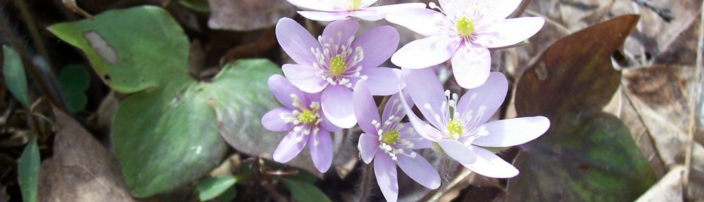
View my wildflower field guide for this trail segment. If you wish to download a copy to your smartphone or tablet for trailside use, simply scan this quick read bar code: