The Peter Desrochers Memorial Country Knolls Trails are located in the Town of Clifton Park. The ~3.5-mile trail system is named in honor of the late Peter B. Roschers and it is under the jurisdiction of the Longkill Park District #1.
A small trailhead parking area is located along the east side of Burning Bush Boulevard just south of Thunderbird Drive; this access point enters onto the Eastwood Trail, which is in the southwest portion of the trail system.
Additional access points to the trail system include:
- From the west side of Terrace Court (either of two entrances onto the Tanglewood Loop Trail (south end of loop or north end of loop), which is in the northwest portion of the trail system);
- From the east side of Terrace Court (onto the Knolls Hollow Brook Trail (west end), which follows along the northern edge of the trail system);
- From the south side of Wood Dale Drive (onto Knolls Hollow Brook Trail (east end), which follows along the northern edge of the trail system);
- From the west side of Sweet Brier Drive (onto South Branch Trail, which is in the eastern end of the trail system);
- From the east side of Knollwood Drive (onto Sweetbrier Trail, which is in the southeastern portion of the trail system); and
- From the north side of Ushers Road (into the south side of the trail system).
View the trails map.
Some views along this trail system:

Lookly S’ly from Wood Dale Drive along Knolls Hollow Brook Trail

Looking S’ly at riparian area along Knolls Hollow Brook Trail
During one of my visits to this trail system (and further upstream along the Terrace Hollow Connector Trail), I observed a native brook trout in this tiny stream! Read more about New York’s official state fish.

Looking W’ly along Knolls Hollow Brook Trail from its intersection with the north end of Sweetbrier Trail

Looking W’ly along Knolls Hollow Brook Trail at its intersection with east end of Pinewood Loop

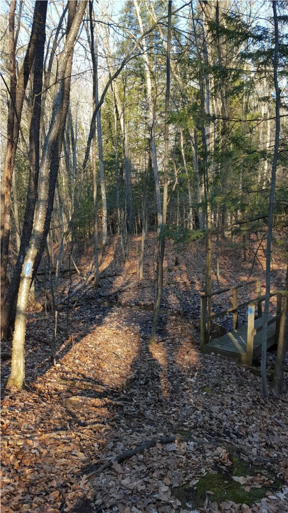
Looking W’ly along Knolls Hollow Brook Trail

Looking W’ly along Knolls Hollow Brook Trail near its intersection with the west end of Pinewood Loop

Looking W’ly along Knolls Hollow Brook Trail at its intersection with west end of Pinewood Loop

Looking WNW’ly along Knolls Hollow Brook Trail from its intersection with west end of Pinewood Loop

Looking N’ly at Hillside Drive (E of its intersection with Terrace Court) along re-routed portion of Knolls Hollow Brook Trail

Looking SE’ly along west end of Pinewood Loop from its intersection with Knolls Hollow Brook Trail

Trail marker along Pinewood Loop (green trail)

Looking E’ly along west end of Pinewood Loop

Looking S’ly along Pinewood Loop toward its intersections with Terrace Hollow Connector Trail (orange) and South Branch Trail (blue)

Looking SW’ly along Terrace Hollow Connector Trail

Trail marker along Terrace Hollow Connector Trail and along Tanglewood Loop (orange trails)

Looking W’ly along Terrace Hollow Connector Trail

Looking WNW’ly along Terrace Hollow Connector Trail

Looking WSW’ly along Terrace Hollow Connector Trail at its intersection with Eastwood Trail

Looking W’ly along Eastwood Trail

Looking SW’ly along Eastwood Trail near its intersection with Southwood Trail

Looking WNW’ly along Eastwood Trail

Looking W’ly along Eastwood Trail toward trailhead parking lot off Burning Bush Blvd

Looking SSE’ly along Southwood Trail near its west end intersection with Eastwood Trail

Lookly NE’ly toward summit along Southwood Trail

270 degree view from summit along Southwood Trail

Looking E’ly at intersection of Southwood Trail and east end of Eastwood Trail

Looking NE’ly along east end of Eastwood Trail toward its intersection with west end of Terrace Hollow Connector Trail

Looking WNW’ly along Terrace Hollow Connector Trail at its intersection with west end of Pinewood Loop

Looking SE’ly along Pinewood Loop at its intersection with west end of South Branch Trail

Trail marker along South Branch Trail (blue trail)

Looking ESE’ly along South Branch Trail
Looking S’ly along South Branch Trail

180 degree SE’ly view from along South Branch Trail

Looking ESE’ly at intersection of Sweetbrier Trail (white) and South Branch Trail (blue)

Looking SSW’ly along Sweetbrier Trail (white) at its intersection with south end of green trail that connects with South Branch Trail

Trail marker along Sweetbrier Trail and Eastwood Trail (white trails)

Looking WNW’ly along Sweetbrier Trail

Looking SW’ly along Sweetbrier Trail

Looking SW’ly along Sweetbrier Trail

Looking W’ly at first of two small kiosks near Knollwood Drive

Looking N’ly at second of two small kiosks near Knollwood Drive

Looking E’ly along small “return loop” portion of Sweetbrier Trail

180 degree N’ly view from intersection of Sweetbrier Trail (white) with South Branch Trail (blue)

180 degree N’ly view from atop ridge along Sweetbrier Trail

Looking NNW’ly along Sweetbrier Trail near its intersection with Knolls Hollow Brook Trail
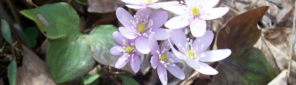
View my wildflower field guide for this nature preserve. If you wish to download a copy to your smartphone or tablet for trailside use, simply scan this quick read bar code:
